
Hien Luong Bridge Ben Hai River is located in the Hien Luong relic complex on both banks at the intersection of National Highway 1A and Ben Hai River in the north of Hien Luong, Vinh Thanh, Vinh Linh, in the south of Xuan Hoa, Trung Hai commune, Gio Linh, Quang Tri province. These are two historical witnesses carrying the pain of dividing the country into two regions North and South for 20 years. Ben Hai River originates from Dong Chan mountain in Truong Son range and flows along the 17th parallel from west to east and flows into Cua Tung sea. Ben Hai River is 100 km long, about 200m at its widest point, about 20-30m at its narrowest point, and is the boundary between Gio Linh and Vinh Linh districts in Quang Tri.
A bridge that divided the country for more than 20 years
Hien Luong Bridge was built in 1928 by the Vinh Linh government mobilizing the people in the area to contribute their efforts. At that time, the bridge was made of wood, with sharp stakes 2m wide, just enough for pedestrians. In 1931, the French repaired the bridge to make it wider, but vehicles wanting to cross the river had to take a ferry. In 1943, the bridge was upgraded, allowing small motor vehicles to pass. In 1950, the French built the Hien Luong Bridge with rolled concrete, 162m long, 3.6m wide, and a load capacity of 10 tons. Two years later, the bridge was destroyed by our army to prevent enemy attacks to the North. In 1952, the French built a new bridge connecting the Ben Hai River between Vinh Linh and Gio Linh districts.

Image of Hien Luong Bridge and Ben Hai River during the war
In 1954, after the defeat at Dien Bien Phu, the Geneva Agreement was signed, temporarily dividing Vietnam into two regions with the 17th parallel as the temporary boundary. Hien Luong Bridge was divided into two parts, each side 89 m long, painted in two different colors. The north bank consisted of 450 bridge deck planks, the south bank 444 planks. The temporary separation was thought to last only 2 years and end after the general election for unification, but in reality it lasted 21 years. In 1956, Ngo Dinh Diem – president of the Republic of Vietnam with the support of the US did not hold a general election to unify the country as stipulated in the Geneva Agreement. From here, Hien Luong Bridge became a historical achievement in more than 20 years of dividing the North and South.

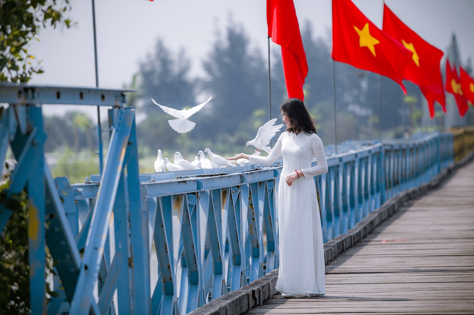
Hien Luong Bridge was restored to its original historical form.
In the battles that took place at Hien Luong, perhaps the “Flag Fight” was the most fierce and fierce battle that took place during the 14 years since the border was demarcated. The height of the flagpole was constantly raised because our flag could not be lower than the puppet flag. When the red flag with yellow star was raised high, the people of the North and South cheered with joy. The Americans and puppets were completely surprised by this event, they quickly increased the height of the flagpole to 35m. In order to not let our flag be lower than the enemy flag in 1962, the government ordered a Vietnamese machine assembly company to manufacture the flagpole and move it to erect at Hien Luong bridge. The flagpole was 38m high, raising a 134 m2 flag, weighing 15 kg. 10m from the top of the flagpole was a cabin for our soldiers to stand, collect and raise the flag. This is the tallest flagpole in the border. For many years after each battle, the flagpole was destroyed, the flag was torn, and a new flag and flagpole were immediately installed in its place. From 1956 to 1967, the border police soldiers hung 267 flags of various sizes.

Hien Luong flagpole is a symbol of the indomitable will of our army and people.
The 21-year war on the banks of Hien Luong was a war against the US to save the country, full of sacrifices and hardships of the army and people. The country was unified and peaceful, some died, some survived, but the contributions of the army and people in the border area were recorded in history books. To this day, coming to this land, we still see before our eyes a heroic and extremely vivid past. In December 1986, the Hien Luong riverside relic site was ranked at the national level. In 2001, Hien Luong bridge was restored to its original state according to the design of the old bridge. In September 2003, the Hien Luong bridge historical relic site was officially started to restore and embellish. In March 2014, Hien Luong bridge was restored to its original state with two colors of blue and yellow as it existed in history. The Hien Luong relics include: Hien Luong Bridge, Ben Hai River, the flagpole on the north bank, the complex, the border police station, the loudspeaker system, the monument cluster of the aspiration for unification on the south bank, and the 17th parallel museum. The current flagpole is a model simulating the flags that the government and army of the Democratic Republic of Vietnam had previously erected.
Travel consultant: 0797 228 777/ 0911 377 268